Lease Survey Vessels for Marine Mapping in Nigeria African Land
Conduct accurate offshore and coastal mapping in Nigeria with African Land’s survey vessel leasing services. Certified vessels and professional crews available.

Lease Survey Vessels for Marine Mapping in Nigeria – Accurate Offshore and Coastal Data
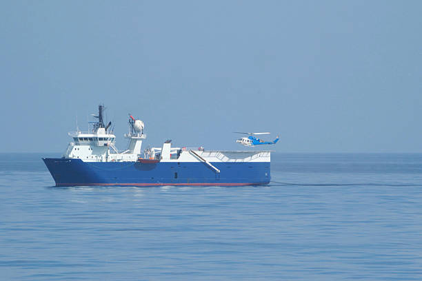
Accurate marine mapping is essential for offshore operations, port development, and coastal infrastructure projects in Nigeria. Survey vessels equipped with advanced hydrographic and geotechnical instruments are critical for collecting reliable seabed and environmental data.
At African Land, we provide clients the option to lease survey vessels for marine mapping in Nigeria, offering certified, well-maintained vessels ready to support a variety of offshore, coastal, and riverine projects.
Why Lease Survey Vessels for Marine Mapping
Leasing survey vessels provides several advantages:
-
Flexibility – lease vessels for specific projects or short-term assignments without long-term ownership costs.
-
Cost-Effective – avoid the capital expenditure of purchasing vessels while accessing high-quality equipment.
-
Operational Efficiency – timely deployment ensures project deadlines are met.
-
Safety and Compliance – vessels comply with NIMASA and international offshore safety standards.
-
Access to Advanced Equipment – vessels come equipped with hydrographic, geotechnical, and environmental monitoring tools.
Types of Survey Vessels for Lease
| Vessel Type | Primary Use |
|---|---|
| Hydrographic Survey Vessels | Map seabeds, coastal zones, and navigational channels. |
| Geotechnical Survey Vessels | Conduct soil and sub-surface studies for offshore construction. |
| Environmental Survey Vessels | Monitor water quality, ecology, and environmental conditions. |
| Multipurpose Survey Vessels | Support offshore construction, inspection, and research projects. |
All vessels provided by African Land are certified, fully maintained, and crewed, ensuring accurate and reliable marine mapping operations.
Key Locations for Marine Mapping in Nigeria
Survey vessels are essential across Nigeria’s strategic maritime areas:
-
Lagos & Lekki – coastal development, port surveys, and hydrographic mapping
-
Port Harcourt / Onne – offshore oilfield studies and industrial site mapping
-
Warri / Escravos – deepwater geotechnical and environmental surveys
-
Bonny Island & Bayelsa – offshore energy and riverine mapping projects
African Land offers vessels for short-term leases, project-specific assignments, and long-term contracts, tailored to client requirements.
Benefits of Leasing Through African Land
-
Certified and Seaworthy Vessels – compliant with all offshore and coastal safety standards.
-
Professional Crew Support – trained personnel handle navigation, vessel operations, and data collection.
-
Flexible Lease Terms – daily, weekly, or monthly leasing options available.
-
Operational Reliability – dependable vessels ensure consistent and accurate marine mapping.
-
Nationwide Access – lease vessels across Lagos, Port Harcourt, Warri, Bonny, and other key regions.
Industries That Benefit from Survey Vessel Leasing
-
Oil & Gas Companies – offshore geotechnical and hydrographic surveys
-
Marine Construction Firms – seabed mapping and site assessment
-
Environmental Agencies – riverine and coastal monitoring
-
Research Organizations – scientific data collection and offshore studies

Comments