RGB, Thermal, LiDAR & Payload Drones: Transforming Nigeria’s Land Sector
From mapping to delivery, drone technology in Nigeria is reshaping real estate and agriculture—partner with African Land.

RGB, Thermal, LiDAR & Payload Drones in Nigeria: Powering Precision in Land and Property Management
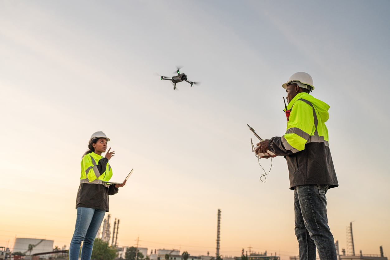
As drone technology evolves, Nigeria is embracing high-performance UAVs equipped with specialized sensors such as RGB cameras, thermal imagers, LiDAR scanners, and payload delivery systems. These advanced drones are reshaping how stakeholders across agriculture, construction, infrastructure, and environmental sectors manage land and assets. For investors and developers, this means better data, faster decisions, and smarter investments.
Types of Drones and Their Applications in Nigeria
1. RGB Drones
RGB (Red, Green, Blue) drones are equipped with standard high-definition cameras. They are commonly used for:
-
Real estate marketing with aerial imagery
-
Construction site monitoring
-
General land surveying and inspection
-
Mapping and orthophoto generation
2. Thermal Drones
Thermal imaging drones detect heat variations and are vital for:
-
Identifying electrical faults in building projects
-
Monitoring crop stress and water usage
-
Search and rescue in emergency zones
-
Security surveillance of properties
3. LiDAR Drones
LiDAR (Light Detection and Ranging) drones use laser pulses to create detailed 3D models and terrain maps. They are ideal for:
-
Topographic surveys for infrastructure projects
-
Forest biomass analysis
-
Flood risk assessment and drainage design
-
Mining and mineral exploration
4. Payload Drones
These UAVs are designed to carry and deliver loads—ranging from medical supplies to agricultural products. In Nigeria, payload drones are used for:
-
Delivering essential goods to remote areas
-
Spraying crops in precision agriculture
-
Supporting emergency response operations
Why These Technologies Matter for Nigerian Landowners and Developers
-
Accuracy and Efficiency: Each drone type delivers specialized data that enhances project outcomes.
-
Cost-Effective Insights: Drones reduce the need for manual labor and expensive field operations.
-
Smarter Land Use: From farmland analysis to urban design, drone data improves planning and zoning decisions.
-
Investment Assurance: Real-time visuals and environmental scans mitigate risk before purchase or development.
How African Land Connects You to the Right Drone Technology
At African Land, we ensure you get access to the right drone solutions for your needs, whether you're acquiring land, developing infrastructure, or managing a large estate. Our services include:
-
Matching drone tech to project goals (RGB, LiDAR, etc.)
-
Partnerships with licensed drone operators
-
Environmental and land use consulting using drone data
-
Support for regulatory compliance and permitting
Whether you need a LiDAR scan of an undeveloped plot or RGB drone footage for your next real estate listing, African Land connects you with trusted tech partners and insights.
The Future: Advanced Drones as Standard Practice in Nigeria
With increased government interest in drone regulation and adoption, high-end drones are quickly moving from novelty to necessity. Developers, investors, and urban planners who leverage this technology early will gain a competitive edge in Nigeria’s dynamic real estate and land management space.

Comments