
Drone-Based 3D Visualization for Nigerian Projects
Need 2D or 3D land models in Nigeria? African Land offers drone services for site mapping, planning, and construction visualization.

Drone Services for 2D and 3D Modeling in Nigeria: Visualize Your Land Like Never Before
In today’s data-driven property and construction sectors, the ability to visualize land and infrastructure in 2D and 3D models is essential for planning, analysis, and decision-making. Thanks to drone technology, Nigerian developers, engineers, and planners can now access accurate digital models of terrain, buildings, and development sites—fast and affordably.
At African Land, we provide drone services for 2D and 3D modeling across Nigeria, helping clients turn aerial imagery into valuable visual data for site planning, land use design, and project evaluation.
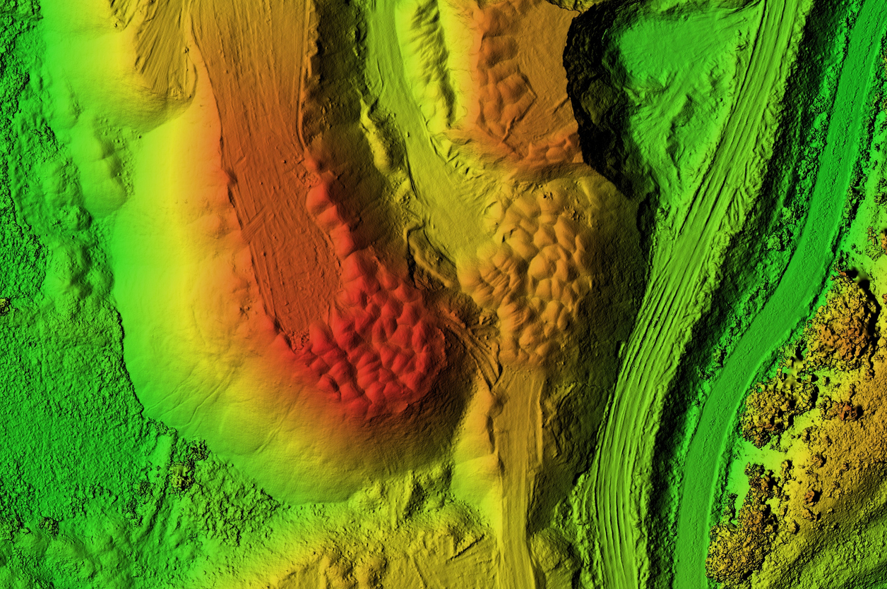
What Are 2D and 3D Models in Land Development?
-
2D Orthomosaic Maps: High-resolution, top-down images stitched together to create accurate, georeferenced site maps.
-
3D Models: Digitally reconstructed surfaces of land, structures, and vegetation, offering elevation, volume, and contour details.
These models are essential tools in engineering, architecture, real estate development, agriculture, and infrastructure planning.
Applications of Drone-Based 2D & 3D Modeling in Nigeria
1. Real Estate Development
Visualize and present land plots, estates, and construction sites. 3D models allow for effective project marketing, layout design, and investor reporting.
2. Construction Planning and Monitoring
Track site progress, earthworks, and building stages. 3D point clouds and mesh models provide accurate volumetric measurements and change detection.
3. Urban Planning and Infrastructure Design
Support masterplans, road layout, and public utilities with terrain-aware 3D models and contour analysis.
4. Agricultural and Environmental Analysis
Model landscapes for irrigation planning, erosion control, and land use management in Nigeria’s diverse terrains.
5. Mining and Industrial Site Mapping
Assess terrain changes, monitor excavation volumes, and manage asset development using high-resolution 3D datasets.
Why Use Drone-Based 2D/3D Modeling Over Traditional Methods?
-
Greater speed and coverage for large or complex sites
-
High-accuracy geospatial data
-
Better visualization for stakeholders and approval boards
-
Compatible with CAD, GIS, and BIM software
-
Cost-effective, repeatable, and scalable
African Land’s Capabilities in 2D & 3D Drone Modeling
-
Orthomosaic maps and elevation models
-
Digital Surface Models (DSM) and Digital Terrain Models (DTM)
-
3D mesh and point cloud generation
-
Integration with planning tools and survey data
-
Custom outputs for architects, engineers, and investors
Whether you’re managing a development in Lekki, constructing in Abuja, or modeling terrain in Plateau State, African Land delivers the visual data you need to plan confidently.
Ready to Build Smarter with 2D & 3D Drone Mapping?
Reach out to African Land today for expert 2D and 3D drone modeling services in Nigeria. We help you unlock insights, improve accuracy, and enhance project outcomes with detailed visual data.

Comments