
Precision Surveying Solutions for Construction and Development
African Land offers advanced land and engineering surveys across Nigeria. Accurate mapping and data solutions for real estate, construction, and infrastructure.

Advanced Land Surveying and Engineering Survey in Nigeria: Precision for Every Project
As Nigeria continues to grow through real estate, infrastructure, and industrial expansion, the need for advanced land surveying and engineering surveys has become more critical than ever. These services provide accurate, technical data that support safe design, legal compliance, and efficient execution of complex projects.
African Land offers expert surveying solutions across Nigeria, combining the latest technology with local expertise to serve developers, government agencies, engineers, and property investors.
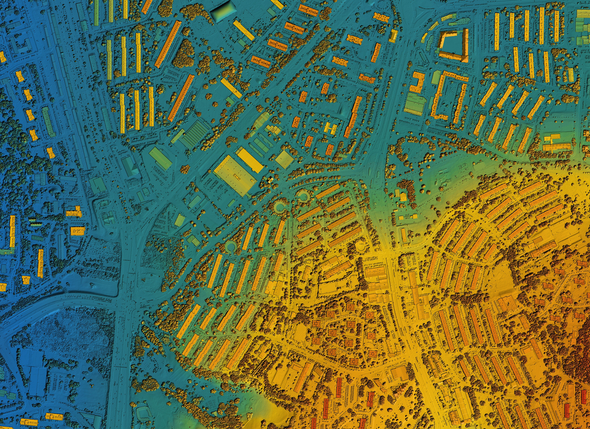
What is Advanced Land Surveying?
Advanced land surveying refers to detailed, technology-driven assessments of land, terrain, and built environments. It supports a wide range of sectors including construction, mining, real estate, and agriculture.
African Land’s advanced surveying services include:
-
Geodetic control surveys
-
Drone-based topographic mapping
-
Digital terrain models (DTM)
-
As-built surveys
-
Hydrographic and coastal surveys
These surveys help clients understand the land’s contours, elevations, and boundaries with high accuracy.
What is an Engineering Survey?
An engineering survey provides essential data for planning and constructing infrastructure. It’s widely used in road design, bridge construction, drainage planning, and utility installation.
Our engineering survey services include:
-
Route and alignment surveys for roads, railways, and pipelines
-
Site layout and construction staking
-
Earthwork volume estimation and grading
-
Deformation and settlement monitoring
-
Drainage and utility mapping
These surveys ensure your project is based on accurate ground data from start to finish.
Why These Surveys Are Vital in Nigeria
-
Design Accuracy: Engineers and architects require precise land data for design and feasibility studies.
-
Compliance: Proper surveys help meet state and federal building regulations.
-
Project Efficiency: Surveys reduce errors, cost overruns, and construction delays.
-
Risk Management: Early identification of land-related issues helps mitigate financial and legal risks.
Industries We Serve
-
Real Estate Development
-
Civil Engineering and Construction
-
Oil and Gas
-
Renewable Energy
-
Urban Planning and Infrastructure
-
Agriculture and Environmental Management
Why Choose African Land
African Land brings professionalism and precision to every project. Our services are led by licensed surveyors using advanced tools such as:
-
High-resolution drone imaging
-
GPS and total station equipment
-
CAD and GIS mapping software
-
Real-time kinematic (RTK) technology
We provide survey reports, digital maps, and models tailored to meet your project’s requirements—delivered on time and in full compliance with Nigerian regulations.
Get Started with African Land Today
Whether you're building an estate in Lagos, constructing infrastructure in the North, or developing a commercial site in Port Harcourt, African Land delivers the accurate survey data you need to succeed.
Contact us to schedule your advanced land or engineering survey today.

Comments