
Professional Drone Mapping Solutions in Nigeria
African Land offers drone aerial mapping services across Nigeria. Get high-resolution maps, 3D models, and terrain data for land and infrastructure projects.

Drone Services for Aerial Mapping in Nigeria: Precision Mapping from Above
In a country as vast and geographically diverse as Nigeria, traditional mapping methods often fall short in delivering the speed, accuracy, and cost-efficiency required for modern development. That’s where aerial mapping with drones comes in. With advanced drone technology, property developers, urban planners, surveyors, and investors can access high-resolution, data-rich maps quickly and affordably.
At African Land, we provide drone-based aerial mapping services across Nigeria to support infrastructure projects, real estate development, agriculture, and environmental management.
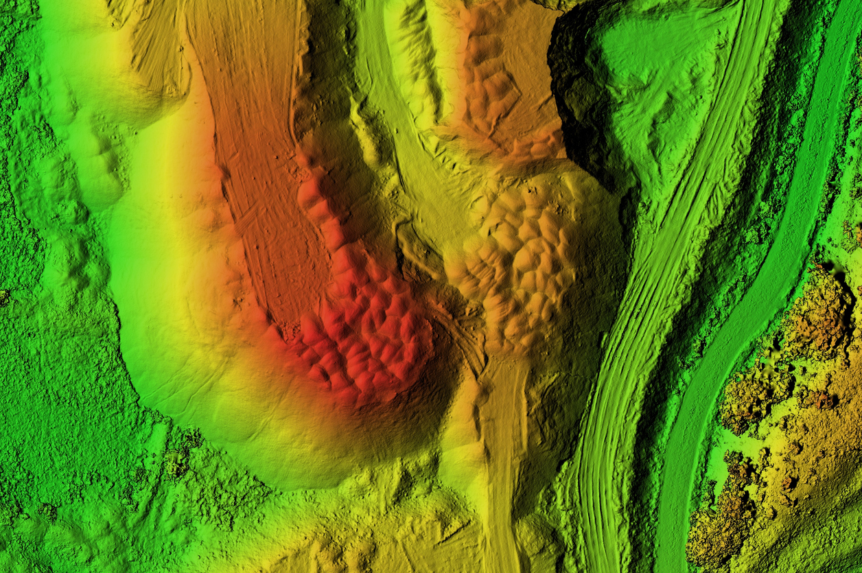
What is Aerial Mapping with Drones?
Aerial mapping involves capturing high-resolution images from above and converting them into orthomosaic maps, 3D models, and terrain analysis. Using UAVs (Unmanned Aerial Vehicles), African Land delivers:
-
Accurate land maps and contours
-
Digital Elevation Models (DEM) and Digital Terrain Models (DTM)
-
Property boundaries and plot layouts
-
Vegetation and land cover analysis
These maps are compatible with GIS and CAD systems used in planning and design.
Where Drone Aerial Mapping Is Used in Nigeria
1. Real Estate and Land Development
Map out estates, subdivisions, and commercial zones with precise boundaries and site plans.
2. Agricultural Land Use Planning
Create detailed maps of plantations and farmlands for irrigation design, crop zoning, and field analysis.
3. Urban Planning and Infrastructure Design
Support road, bridge, and public utility design with accurate topographic and elevation data.
4. Environmental and Erosion Monitoring
Track changes in land use, deforestation, and erosion patterns in ecologically sensitive areas.
5. Oil & Gas and Industrial Projects
Map out pipeline routes, facility layouts, and project impact areas.
Why Use Drone Mapping Over Traditional Methods?
-
Greater accuracy and resolution
-
Faster turnaround for large areas
-
Cost savings on manpower and logistics
-
Access to remote or difficult terrains
-
Detailed outputs for regulatory submissions and planning
African Land’s Aerial Mapping Capabilities
Our services are tailored for landowners, engineering firms, government agencies, and developers. We offer:
-
Orthophoto and contour map generation
-
2D and 3D mapping outputs
-
Drone data integration into GIS platforms
-
Licensed drone pilots and survey team support
-
Full coverage across Nigeria’s six geopolitical zones
From commercial zones in Lagos to agricultural lands in Taraba, African Land delivers reliable, precise aerial mapping services to support better planning and development decisions.
Request Drone Mapping Services Today
Looking to map your land or development site accurately and efficiently? Contact African Land for expert drone aerial mapping services in Nigeria. We deliver high-quality data to help you plan, build, and manage your projects with confidence.

Comments