
UAV Survey, Mapping & Surveillance Services in Nigeria
African Land provides UAV services for land survey, mapping, inspection, and surveillance across Nigeria. Fast, accurate, and cost-effective drone solutions.

UAV for Land Survey, Surveillance, Inspection and Mapping in Nigeria
In Nigeria's evolving land and infrastructure landscape, Unmanned Aerial Vehicles (UAVs)—commonly known as drones—are revolutionizing how surveys, surveillance, and mapping are conducted. UAVs offer faster, safer, and more cost-effective solutions for property developers, construction firms, government agencies, and investors.
At African Land, we deploy UAV technology across Nigeria to deliver reliable data and visuals for land surveying, site inspections, aerial surveillance, and mapping. Our drone services help clients make better decisions, mitigate risk, and manage assets with precision.
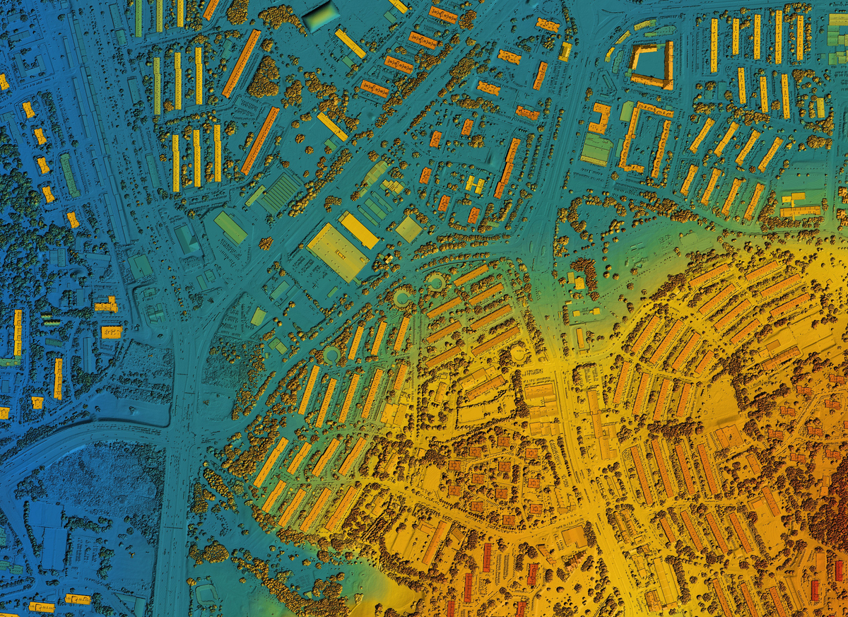
UAV for Land Surveying in Nigeria
Traditional land surveys can be slow and labor-intensive, especially on difficult terrain. UAVs enable:
-
Aerial topographic surveys
-
Contour mapping and elevation modeling
-
Digital terrain models (DTM) and orthophotos
Our UAV survey services are ideal for large plots, agricultural estates, infrastructure corridors, and urban development projects across Nigeria.
UAV Surveillance for Property and Infrastructure
For estate management, remote site security, and industrial monitoring, UAVs offer real-time aerial surveillance with high-resolution video and thermal imaging. Applications include:
-
Perimeter surveillance for gated estates and farms
-
Monitoring of oil & gas pipelines
-
Oversight of utility infrastructure and road networks
-
Remote access to high-risk or sensitive areas
African Land helps clients detect threats, monitor activity, and secure large or inaccessible areas across states like Lagos, Rivers, Kaduna, and Ogun.
UAV Inspection Services in Nigeria
From rooftops to tower structures, UAVs reduce inspection time and eliminate the need for scaffolding or cranes. UAV inspections are used for:
-
Construction site progress tracking
-
Power line and transmission tower inspections
-
Roof condition assessments
-
Bridge and infrastructure evaluations
We support engineering firms, facility managers, and real estate developers with detailed UAV inspection reports and visual records.
UAV Mapping and GIS Data Collection
For planning, zoning, and environmental studies, UAVs deliver accurate geospatial data integrated with GIS software. This supports:
-
Urban and rural land use planning
-
Layout design for estates and industrial parks
-
Environmental and erosion monitoring
-
Disaster impact assessments
African Land provides processed UAV maps and models ready for use in architectural and engineering applications.
Why Choose African Land for UAV Services in Nigeria
-
Certified drone pilots and licensed surveyors
-
High-resolution imagery and data analytics
-
Fast turnaround and nationwide coverage
-
Integration with GIS, CAD, and planning platforms
-
Full compliance with Nigerian aviation and survey regulations
Book UAV Services with African Land
Looking to survey land, inspect infrastructure, or secure your property with advanced UAV solutions? African Land is your trusted partner for drone-based services in Nigeria. We bring precision, safety, and speed to every project.

Comments